
This view of an early morning sunrise over Rockport, Massachusetts, is actually composed of four separate images captured quickly one after the other, and then later, stitched together during post-processing to create this panoramic image.
In 2019, Billie and I, and our good friends, Lew and Louise, planned a trip for 2020 to New England that would have taken us through several eastern states as well as bits of Canada for slightly over two weeks. But in 2020, we didn’t travel at all for reasons most everyone understands. We decided to try and make up for it in late September of 2021 by putting together a much less ambitious version of that 2019 plan that would keep us (almost) totally inside Massachusetts.

This annotated Google map segment provides a rough visual outline of our trip. We flew into Boston to meet up and then drove south to the town of Wareham. We used a hotel there as our “base camp” from which to make day trips; to Provincetown at the tip of Cape Cod, to Martha’s Vineyard by ferry, and to Newport, Rhode Island (our one jaunt outside Massachusetts). Then, we turned north and drove to the town of Rockport on the less well-known Cape Ann where we used a rental house as our base. Finally, we headed back to Boston for a stay at a downtown hotel for our last few days together before returning to our respective homes in California and Florida.
Southeastern Massachusetts
Provincetown is certainly a tourist-focused town although it has its own kind of open and cheerful funkiness about it. We spent most of our visit there along the area most appropriately called, Commercial Street. Here’s a slideshow of some of what we saw while there.

Commercial Street telling it like it is! 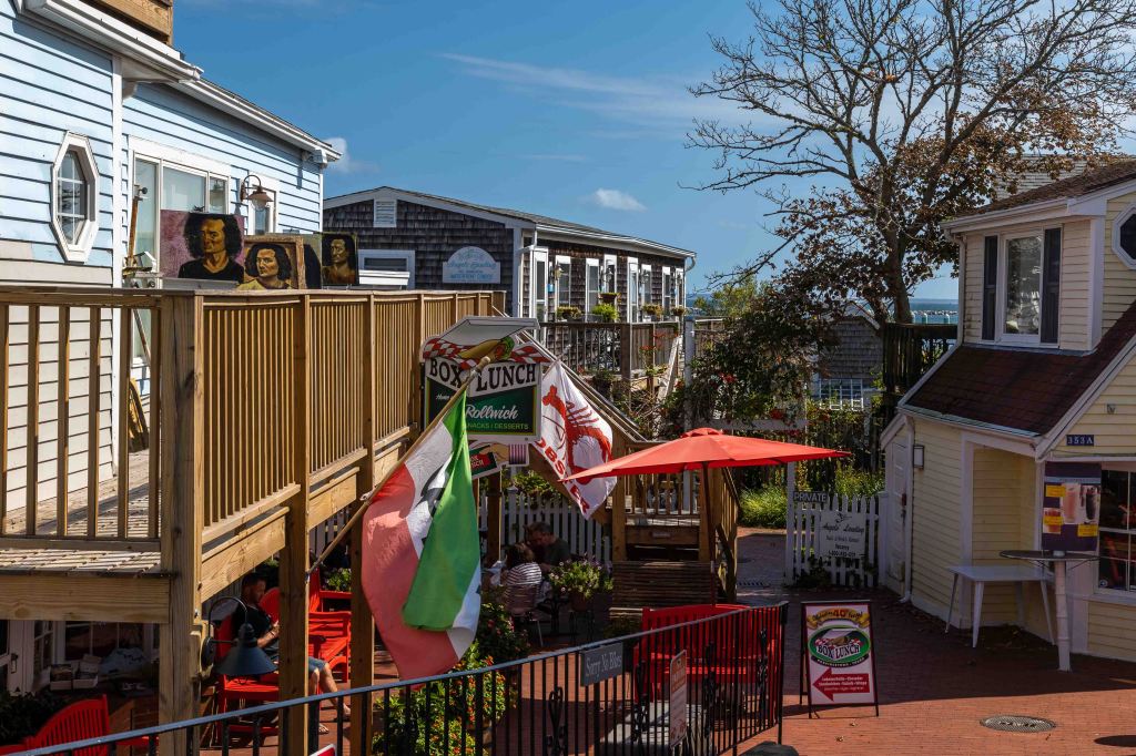
A place to eat called “Box Lunch” 
Looking for a Hat? This place is called “Mad as a Hatter” 
Louise & Lew (l-r) checking out the beach 
Lew, Billie, Louise (l-r) walking up Commercial Street, Provincetown, MA 
Somerset House Inn (a purple place) on Commercial Street, Provincetown, MA 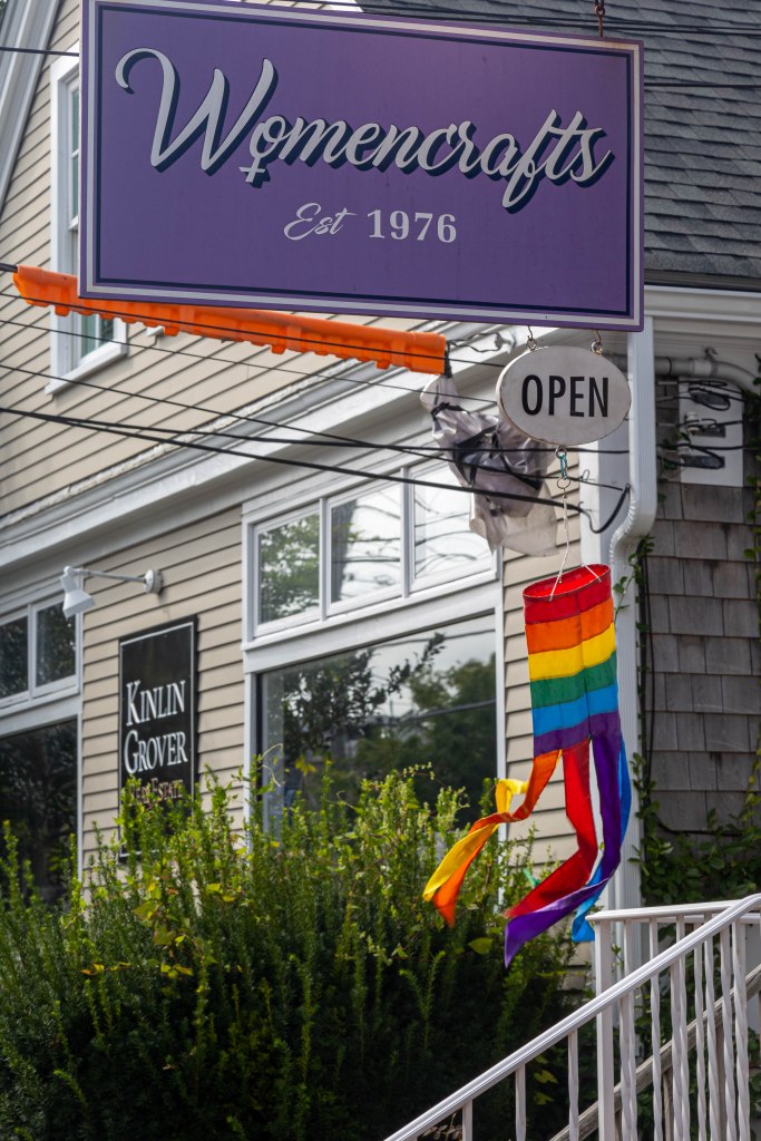
Womencrafts, Commercial Street, Provincetown, MA 
Provincetown Public Library, Commercial Street, Provincetown, MA 
Tee-shirt for sale on Commercial Street, Provincetown, MA 
Interesting art seen on Commercial Street, Provincetown, MA
While we were exploring Commercial Street I happened to see this man and his (service) dog. I must admit that I was initially drawn by the color of his shirt but when I noticed he was (unknowingly, I believe) standing almost perfectly centered between his dog and the cute inflatable one to his left, I knew it was worth capturing an image. The unleashed, quite rotund, dog, looks really friendly and anxious to join the group. I don’t think it happened but they were all still standing there when I moved on.

After awhile, we left Provincetown but before heading back to our hotel, we visited a much less developed area called Province Lands. The first image is of some of the dunes taken from a nicely paved bicycle path; the second is of what appears to be a fairly popular spot — Herring Cove Beach.


Our next “adventure” was a trip to the island of Martha’s Vineyard. The first step, for us, was deciding how to get to and from the island. We selected Steamship Authority (SA) as our ferry company of choice. If you are taking a car with you, you must make reservations. We only intended to stay around the more populous towns on the northern edge so opted to go as pedestrians. It is possible (and encouraged) to buy tickets online with a smartphone and then just use the phone to gain admittance to the boat of choice. There are multiple departure terminals available. We chose the closest one to Wareham at Woods Hole, and then used the clever app to find the next available parking lot (maintained by SA) where we left our car and boarded an SA bus to the pier.
Our ferry took us to Vineyard Haven on the island — one of a couple of choices. Once there, we wandered around this smaller town for a little while and then decided we would head over to the slightly larger town of Oak Bluffs. I only took one photo while in Vineyard Haven of an unusual weather vane.

We caught a cab and to take us to the slightly larger town of Oak Bluffs. Among other things, it is apparently well-known for its section of ‘gingerbread’ houses. Here’s just a few that we saw:


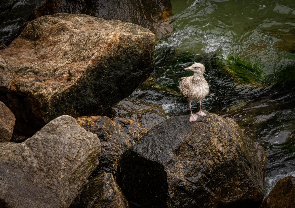
After walking around the gingerbread homes and other parts of town, we stopped off to get some lunch (and to get out of the light rain). Then we headed to the Oak Bluffs ferry terminal to wait for one that was heading back to the Woods Hole terminal. While we waited, I watched a gull which seemed to be standing watch; it was standing on the rock as seen below and turning this way and that to keep an eye on everything that was going on — a very diligent sentry.


While we were waiting, a smaller ferry came by but was going to a different mainland terminal. It wasn’t long before our ferry arrived and we climbed aboard just as it began to rain once more.

We took one more day trip while in the Cape Cod area; to Newport, Rhode Island and while there took an audio guided tour of all the mansions (summer cottages) of the millionaire families who used to vacation there. Then we headed back to our base camp in Wareham to pack up for the next day’s drive to northeastern Massachusetts.
Northeastern Massachusetts
The drive from Wareham to our house rental in the town of Rockport took us close to three hours since we had to contend with Boston commuter traffic along the way. However, the house, situated on the coast of Cape Ann was ideally located with both sightlines to the coast and ocean and was only a very short walk away from a large pier. Especially from a photographer’s perspective, this was a terrific base-camp location.

The front of the Rockport house 
The back of the Rockport house (top/brown/center) as seen from the harbor 
A view of the harbor / marina 
The Granite Pier during the day as seen from the house
I was able to capture the sunrise image shown at the top of this post by heading down to the Granite Pier before the break of day (the pier is shown above, during midday) but without the RV and all those other cars around. Then I just waited a while for the sun to begin to rise and light up the clouds. The photos for the panoramic image at the top of this post were captured then.
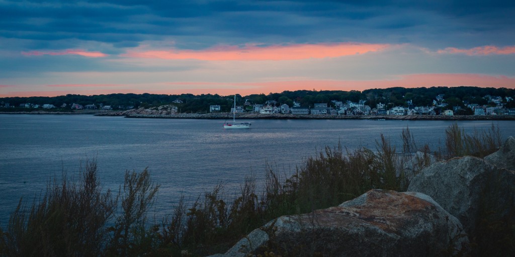
Here’s another sunrise image, this one captured from the back of our rental house, on a different day, and about an hour later than the panoramic.

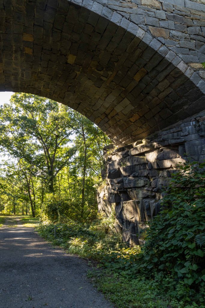
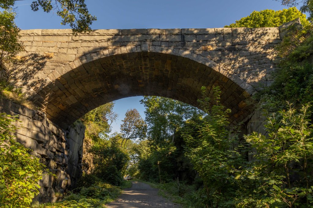
Rockport is a town that initially quarried granite which likely explains why so much of the town uses granite as a basic building material. Very near our rental house is a bridge that supports the road (Highway 127) that crosses a ravine. The bridge is called the Granite Keystone Bridge. At first, I thought it would include a river or some other water barrier. But I later learned that most of the quarries had become lakes and reservoirs and that the ravine is one of the ways into that particular reservoir area. So, one afternoon I headed down to the wharf below the house and followed the path leading to the reservoir. I was glad I took my camera along since the rocks forming one side of the lake were quite colorful and the bridge was a great deal more picturesque from below than it was from above when it appeared to be just a piece of road.

Boston
Not long after these last few images were taken, we packed up and headed to Boston. We turned in the rental car at this point feeling we wouldn’t need it in a big city (nor the parking hassles that are implied). We did spent a lot of time walking around town, particularly to our dinner choices in the evening. We visited the aquarium and walked the couple of miles from it back to the hotel. We took an amphibious vehicle tour which was kind of fun. Most importantly, we made some tentative plans to make definite plans to get together again soon (looks like early in 2022 for our next trip). Eventually we went to the airport for our flights home.

You are amazing. Thanks for the documentation and travelogue
LikeLike