In April 2020, with the Covid-19 pandemic well underway, I published a blog post about going back through a few existing photos in my archive, mostly never seen by anyone before, as an alternative to traveling even locally for photography. Then in May I tried going out to our garden to actually take photos (of mostly flowers) as a way to retain, and maybe even enhance my image-making skills, and posted another blog with the result of that effort.
It is now July, the pandemic is unfortunately still going strong (and even stronger, in some quarters) and I’ve decided to return to the idea of reviewing my image archive again since I often take many different photos while in the same location but never publish everything; my hope is that I’ve found new images that might be of interest.
My archive includes photos that cover nearly two decades of digital photography; for this review I selected images from 2018, 2017, and 2016 (only through May of that year – we travelled a lot in 2016 so there are more photos than I want to review right now). The images shown in this post have also been added to my photography website but because none of the images are recent, they won’t appear in the What’s New section (contents of that section are auto-selected by creation-date). I mention this so that if you see an image that you would like to look at larger and in more detail, the photography website provides a much better view. That www.CedBennett.Photography website is basically organized by location; this post will also follow that pattern (more-or less) and also provide direct links to the images or their containing albums.
I’ve also posted the newly published images to my Flickr account, if you prefer. Those albums are organized by year so I’ve added the creation date to the caption of these selected photos, as well (temporarily).
California
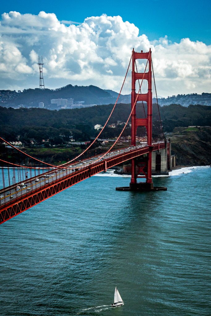
Starting closer to home, here’s a view of the world famous Golden Gate Bridge (which is never golden but continuously painted in this rust-inhibiting red color). The view is from Conzelman Road in the Marin County side of the National Golden Gate Recreation Area, toward what used to be the U.S. Army’s Presidio in San Francisco and which is now part of that same National Recreation Area.
In the bay below the bridge is one lonely sloop looking like it is heading out into open ocean.
This photo, from March 3, ’17, can be found here, along with other Bay Area images, on my photography site.
Another location not too far from home is Point Reyes National Seashore — about two hours drive north of this bridge and a place where I’ve spent several weekends over the years attending photography workshops with other avid amateurs led by professional photographer, Gary Crabbe. Here is a link to his amazing website.
All of the photos in the slideshow below can be found in this album, along with many others from Point Reyes and a (very few) other northern bay area sites. Point Reyes can also be found in the Point Reyes album under the Special Subjects > US National Parks menu item on the photography site.
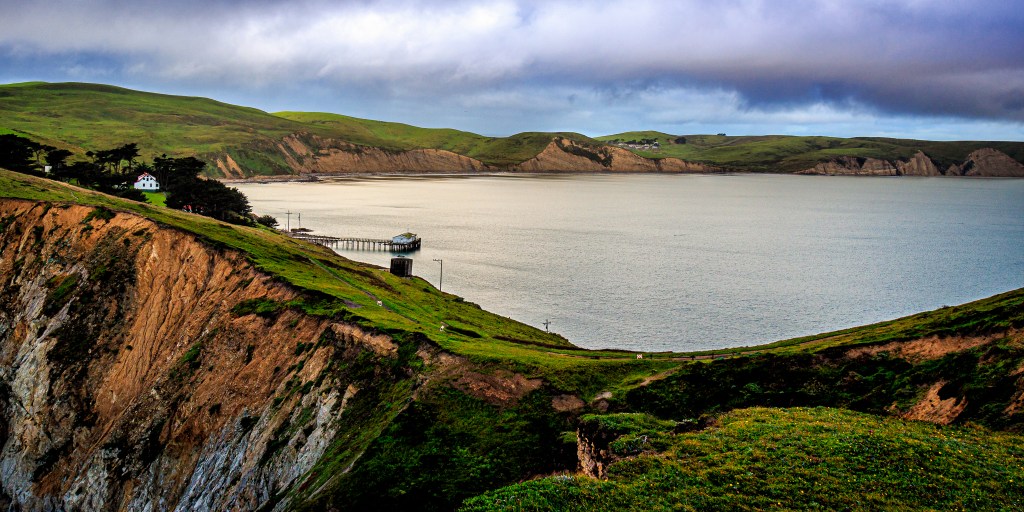
Drakes Bay in the morning from the headlands showing the Chief’s House and the Old Fish Dock – 3/4/17 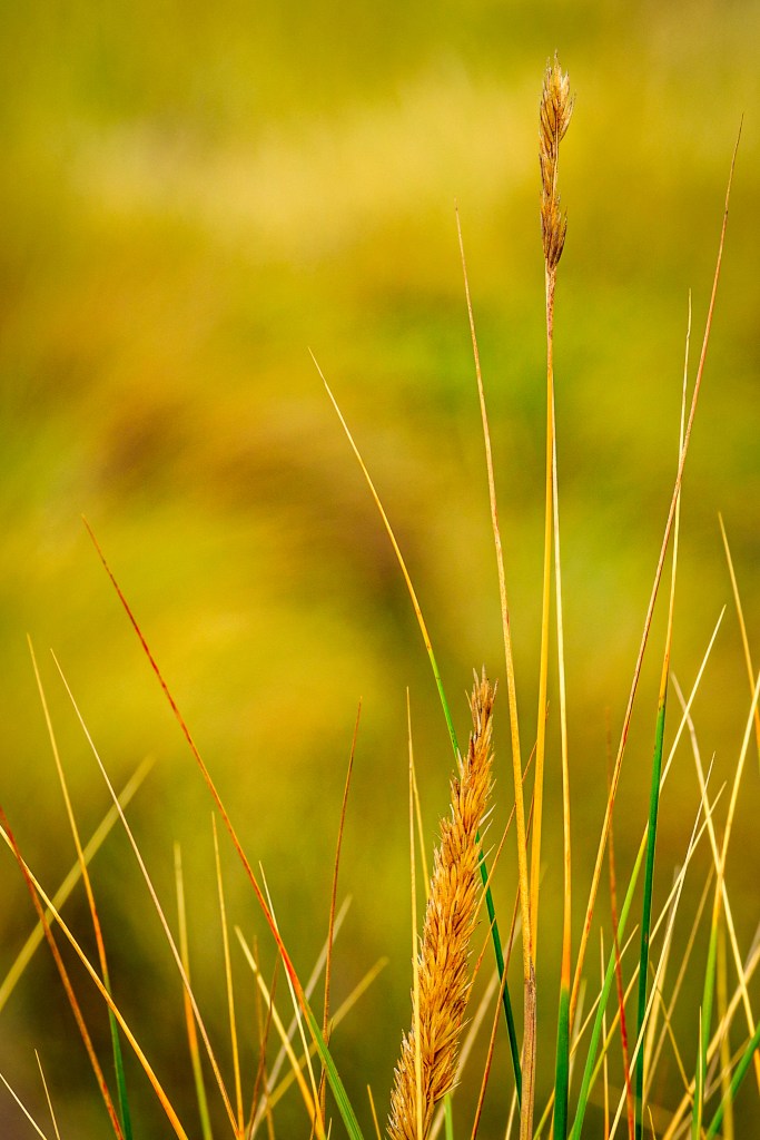
August beach grass at Kehoe Beach – 8/25/18 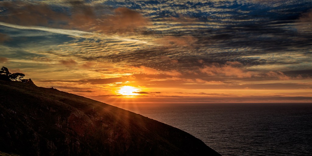
Sunset over Point Reyes Headlands – 3/3/17 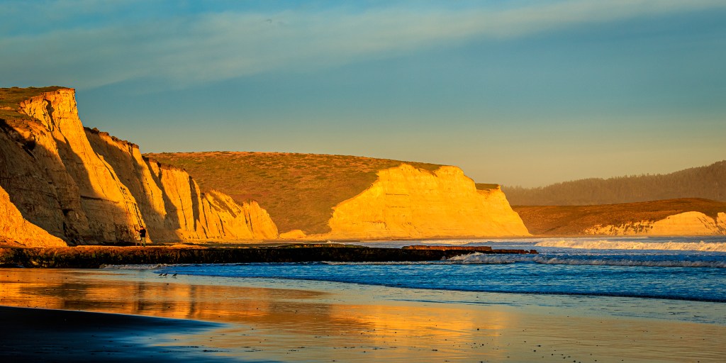
Almost sunset at Drakes Beach – 2/13/16 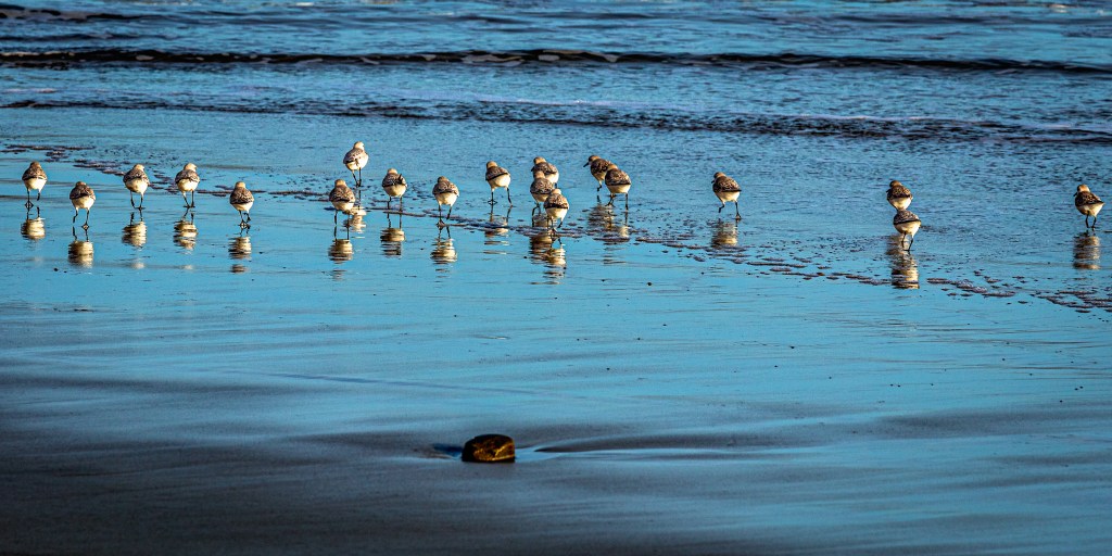
Drakes Beach: Was it something I said? – 2/13/16 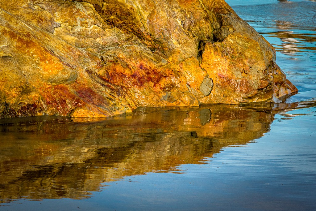
Drakes Beach: Hidden colors in the rock revealed by the ocean – 2/13/16
There is one other location in California (and Nevada) where we like to spend time (when travel is a reasonable option) and that is Lake Tahoe. We typically stay in the community of South Lake Tahoe, just south of the border between California and Nevada; we do make day trips to other parts of the Lake in both states whenever we visit. Since neither of us are skiers we do avoid the winter season, thankful that in most of California the snow is very well behaved — staying in the mountains where it belongs.
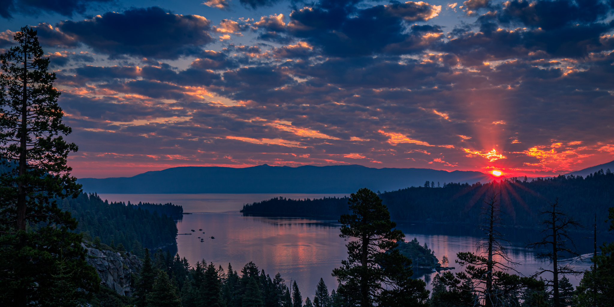
One of the locations I love to visit, usually early in the morning to take advantage of sunrise colors, is just above Emerald Bay on the southwest end of the lake in California. The image at the top of this post, captured on September 3, ’17 is one such photo, caught just as the sun was cresting the mountains to the east and breaking through fairly dense cloud cover. This image, and others from the Lake Tahoe area are found in the North Eastern California album on my photography site. That album also includes photos from Lassen Volcanic National Park, the Lake Almanor region, the Surprise Valley area, and even McArthur-Burney State Park.
The two photos below were also captured from the same location as the Emerald Bay image; there are several other quite different images from Eagle Falls in the North Eastern California album mentioned above:
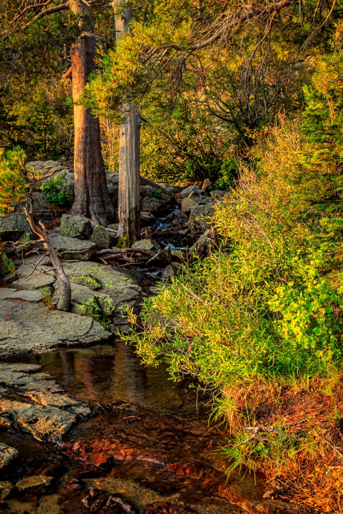
Eagle Creek, supplying Eagle Falls, Lake Tahoe, CA – 9/6/17 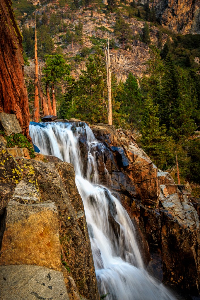
A steeper section of Eagle Falls, Lake Tahoe, CA – 9/6/17
Some other western states
In normal years, we often visit the island of Maui in the state of Hawaii (not this year, of course — the idea of a two-week automatic quarantine pretty much discouraged that idea). When there, we stay at the Napili Kai Beach Resort at the very north end of West Maui on Napili Bay. The slideshow photos below are from my archive that have not been published before. Other images of Maui can be found in the Maui album on my photography website.
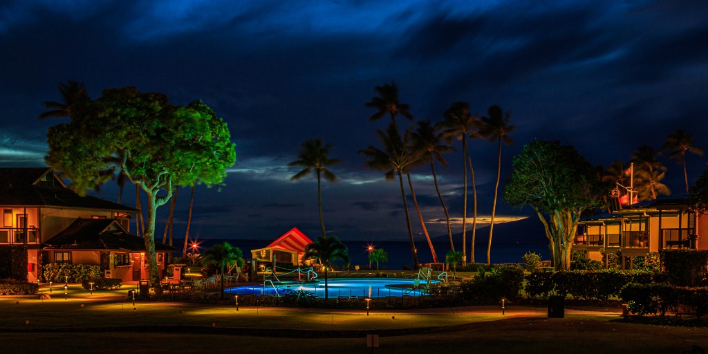
Evening begins early at Napili Bay. The cabana in the middle of the photo is the site of a daily mid-morning coffee and Hawaiian culture presentation – 5/26/18 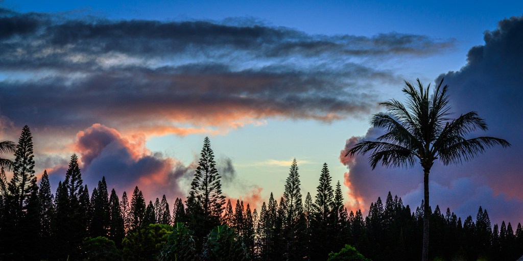
Color in the sunrise clouds over the trees at Napili Kai Beach Resort where no buildings are taller than the palm trees – 5/21/17 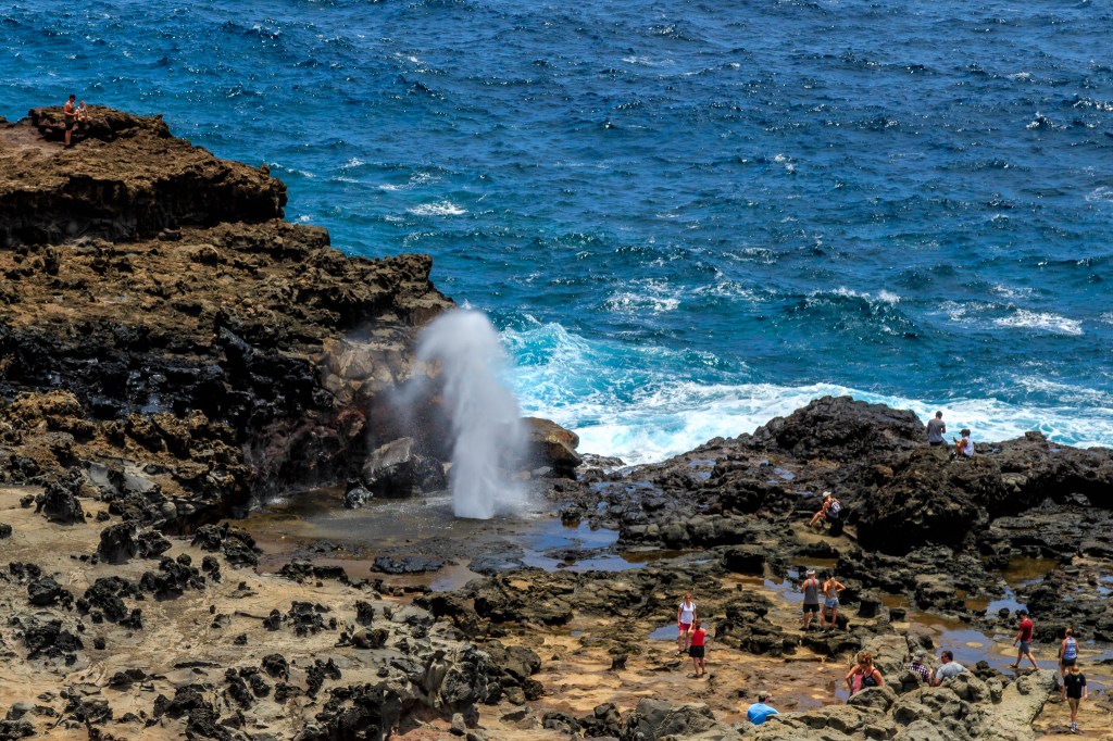
Lots of visitors to the Nakalele Blowhole further around the north end of West Maui. It is a moderate rock scramble to get down and back to see this up close – 5/27/18 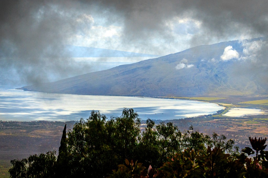
View of Kihei on the near coast, the south end of West Maui, and the island of Lanai beyond that — all through the clouds at the Alii Kuka Lavender Farm about halfway up Mount Haleakala – 5/23/16
In April of 2017 we took a river cruise down the Snake and Columbia rivers with our travel buddies, Lew and Louise. This image, and others from that trip (as well as other visits to the region) can be found in the Washington & Idaho album; other related images can also be found in the Oregon & Nevada album.
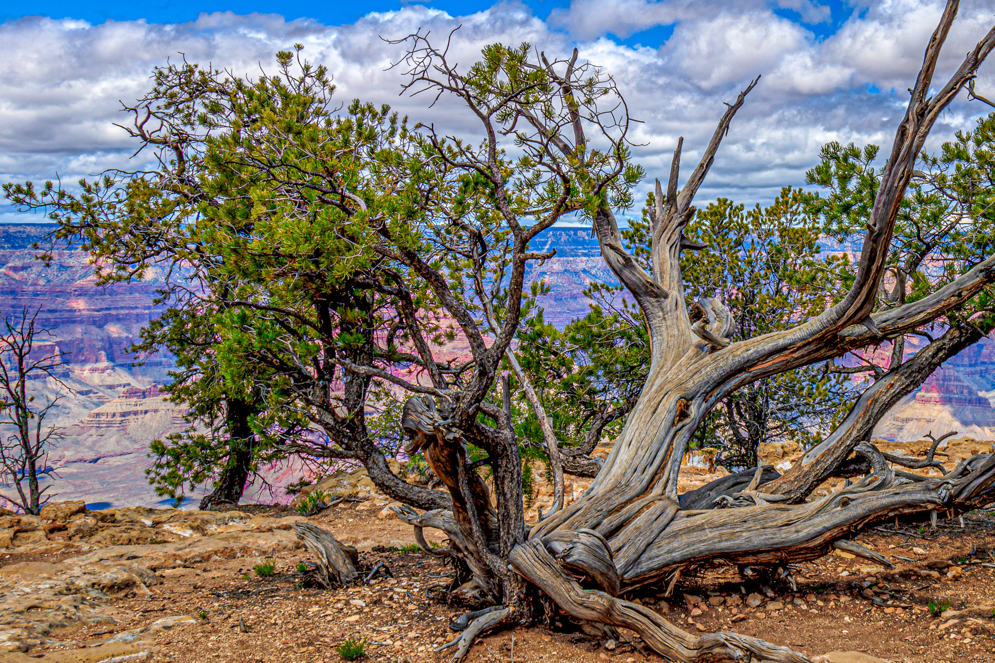
In both 2016 and 2017 we explored parts of the western states of Arizona, Utah, and Nevada via road trips — one trip with the same travel buddies. One of those road trips included stays in the Grand Canyon and Zion National Parks. Interestingly, neither of the two archive images I selected from that trip feature the actual canyons of either park but rather some plants that caught my attention while we were there (drag the arrows in the middle of the double-image below to the left and the right to view each image completely). Other (probably more traditional) photos from these parks can be found in the Grand Canyon and the Zion albums (or by visiting the Arizona album or the Utah album) on my photography website.
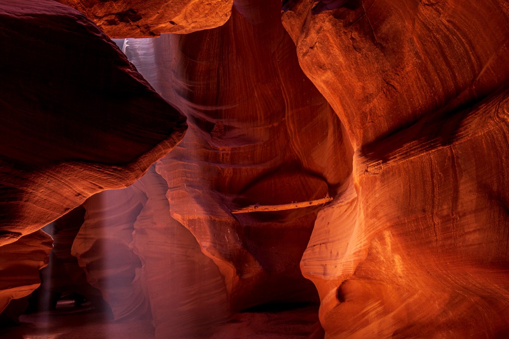
That road trip, which started in Zion NP and ended at Grand Canyon NP (not counting the drive from and to California) provided us with a planned opportunity to stop in Page, AZ in order to visit the very picturesque Antelope slot canyons located nearby within the Navajo Nation. We spent a couple of days photographing both the Upper and Lower Antelope Canyons while we were there. This image can be viewed larger here in the Arizona album. By using the arrow keys or the arrows on that image you can review other photos from both canyons.
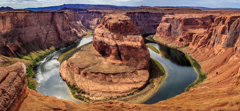
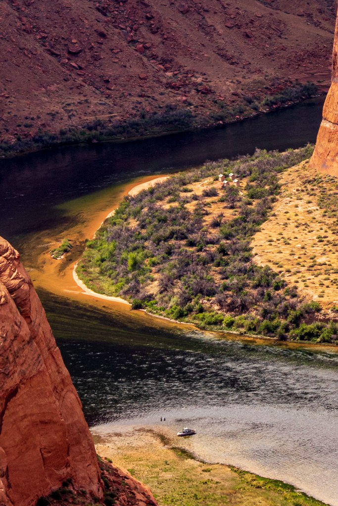
Even though we’d planned most details of our road trip ahead of time, I had failed to note that Page was also within a few miles of another site worth photographing — the section of the Colorado River known as Horseshoe Bend. I quickly set aside some time to hike over the canyon and photograph this natural wonder.
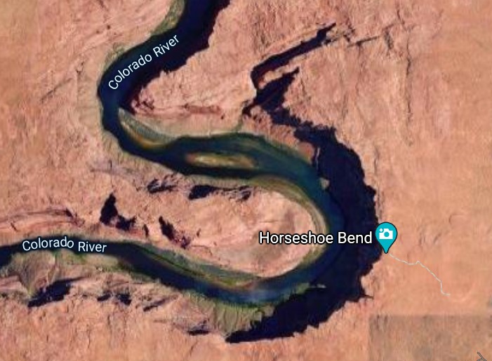
Horseshoe Bend is a place on the Colorado River where the course of the river makes an approximately 270° turn. The photo at the top-left of the four-image layout below can be viewed on my photography website here in the Arizona album (this image is one that has been on the website since the spring of 2016 so is NOT an archive photo). None of the other three images have been posted to my photo website but are here to support some additional observations. The Google Map satellite image at the top-right is here to provide a bird’s-eye-view of the site; once the river leaves Horseshoe Bend it meanders west for a while and then turns south for several tens of mile before turning west again to enter the Grand Canyon.
The bottom-left photo is a telephoto-lens view of the river entering the bend. I captured that image while there because there were some interesting features that didn’t become clear until later when I was post-processing the images. Those features help to visually establish the scale of Horseshoe Bend for the viewer; the actual distance from the photographer to the beginning of the bend is about one mile and the height of the canyon from plateau to river is roughly 1,000 feet.
At the very bottom-center of that left photo you can just see that there is (are?) something(s?) in the water. Also, directly above that on the opposite shore just where the river starts to turn into the bend, there are what appears to be some structure(s?). The bottom-right image is just a much tighter crop of a part of the image on the left which allows us to see a bit more detail. Clearly the ‘somethings’ near the bottom center are a power boat which has been beached and the specs to its left are two people, standing in the river (maybe using the water to cool down?, maybe fishing?, something else?). The four structures on the opposite shore might be small, temporary sleeping cabins or possibly out-houses.


Finally (at least for this blog post), the November ’17 road trip with our travel buddies took us to Sedona, which we had fun exploring for several days.
Only a very few photos from that trip were posted to my photography site. You can see a larger version of this one on the left from the Bell Rock Trail by clicking here and then using the keyboard arrow keys (or click on the arrows on the screen) a couple of times to the left and/or right to see the other Sedona area images.
I hope you enjoyed seeing some of these (previously) only archive photos. Let me know in the comments below if you’d like me to do more like this. Hopefully, I’ll soon actually be out again scouting sites and creating new images. Meanwhile, please be well and stay safe.
I can hardly use the word “meanwhile” anymore without automatically thinking of Stephen Colbert and his “Meanwhile” (currently “Quarantine-while“) show-segment on “The Late Show with Stephen Colbert”.

Ced your photography is absolutely beautiful!
Thank you for sharing your remarkable talent.
Take care 😀
LikeLike
Linda, I do so appreciate your kind comments. Thank you. Hope to see you soon, Ced
LikeLike