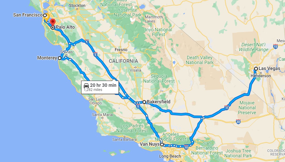
Basically, the road trip was to San Francisco, Monterey, and Las Vegas with side trips in the vicinity of each location and finally, of course, a return home (image courtesy of Google Maps).
Once again, we set out to explore, but more importantly to hang out with our traveling friends, Lew and Louise. We picked them up at the airport and headed into San Francisco to enjoy the fact that the City was beginning to cautiously open — while also doing our best to remain healthy (e.g., up-to-date Covid-19 vaccinations, wearing masks, keeping our distance from people we didn’t know).
We also used the time away from our respective homes, and all the daily responsibilities that seem to consume big chunks of time, to simply allow ourselves to relax and enjoy it. We started the trip on 21 February and continued it into early March. Once we were back home again, several of those ‘at home’ responsibilities kept us busier than usual which, in my case, accounts for the delay in processing my photos and getting this blog post (finally) written.
San Francisco area
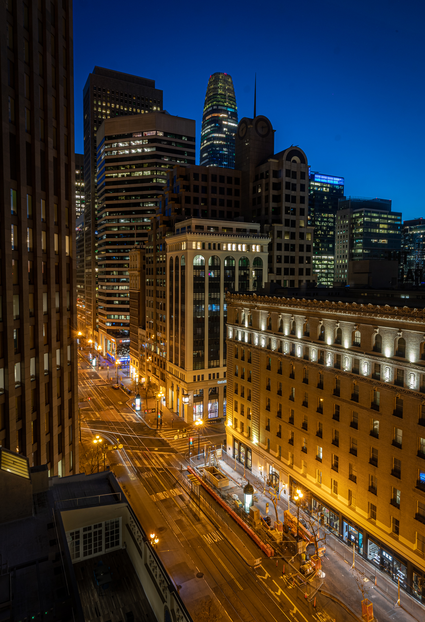
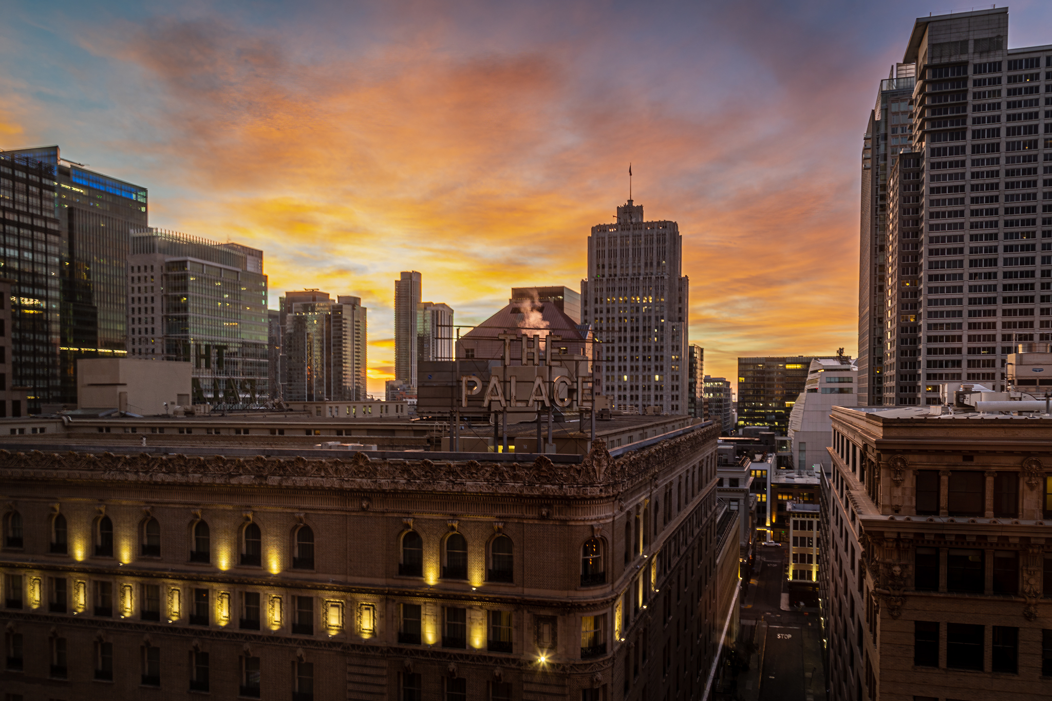
We stayed in a very comfortable two-bedroom apartment downtown on Market Street. That provided me with the opportunity to take a few early morning cityscape shots without having to venture out into the cold or even change out of my sleeping clothes. The three-image slideshow below gives an idea of our view.
Market Street has become limited primarily to just buses and taxis so there is little traffic except at intersections. In the first image, looking east along Market (which was a relatively long-exposure of 25 seconds, f-stop of 16, ISO at 200) and taken before sunrise you might be able to see light-trails of vehicles both at the intersection and coming up the street. The second image was a much faster long-exposure of only four seconds (f-stop 16, ISO 400) taken a bit later that same morning. You can see a bus stopped in the lower-left of the image. The third image was captured on a different day and oriented toward the sunrise scene directly across Market toward the Palace Hotel and other buildings to the south (exposure of only 0.5 sec, f/9, ISO 100).

Some of our time was spent exploring parts of the city and searching for interesting places to have dinner. We did take some side trips; the most fun was driving north of the City, across the Golden Gate Bridge, through Marin County and into the Sonoma Valley to do some wine tasting (and buying) at Alexander Valley Vineyards. I wandered around the vineyards near the main building before we left and got these two images.
(1/40sec f/9 ISO 100)
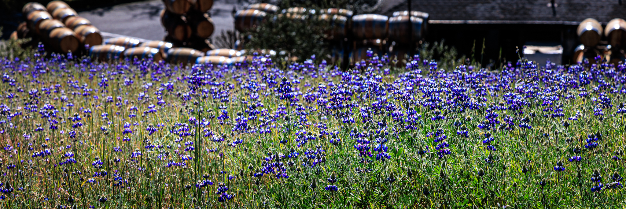
(1/200sec f/9 ISO 100)
Monterey area
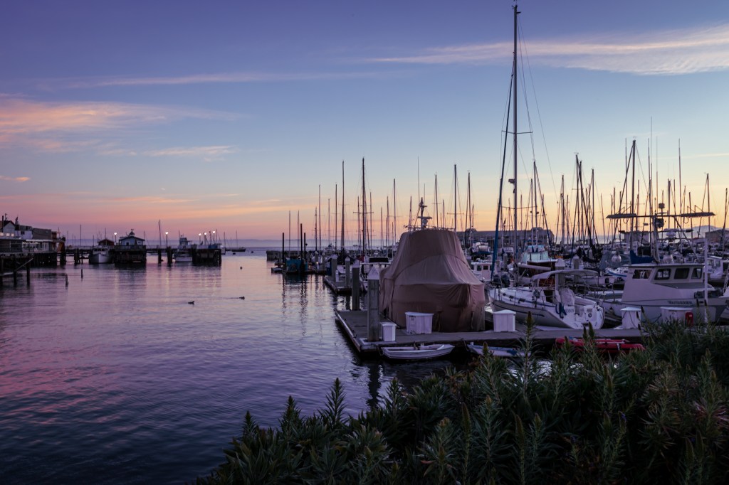
When our time in San Francisco was over, we drove down to Monterey and checked into a hotel close to Old Fisherman’s Wharf. As we did in the City, some of our time was spent just walking around and spending time together. We did head over to the Monterey Bay Aquarium to see what had changed since our last visit several years ago.
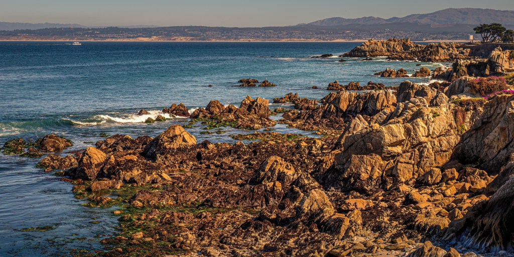
One day we were talking and realized that none of us had been on the famous 17-Mile Drive for many, many years (decades?). That drive, along the very well preserved natural and gorgeous coastline just south of Monterey which includes Spanish Bay, Pebble Beach, Spyglass Hill, the Lone Cypress, championship golf courses, luxury resorts, and many custom designed homes does require a fee for tourists like us. So we rented a tour-guide app for the trip and headed toward the northern Pacific Grove entrance to the drive. The tour guide app actually provided us with a tour of the drive approach through Monterey and Pacific Grove along Ocean View Boulevard (primarily the somewhat protected southern edge of Monterey Bay) and then Sunset Drive (directly facing the Pacific Ocean) right up to the gate. Later in the day, we drove back to Ocean View Blvd and I grabbed a couple of late afternoon shots from that fairly calm, protected section of Monterey Bay.
The top photo shows some of the sandy Monterey Bay coastline and the hills beyond in the background, a bit of the Lovers Point Park outcropping in the middle ground, and just some of the rocky coast in the foreground (1/200sec f/9, ISO 100). The image below is just a closer shot of the rocky shore (1/320 f/9 ISO 100); I took it because of the two sea birds that had each claimed a rock of their own for resting (the dark coloring of the bird on the further rock may make it hard to see).
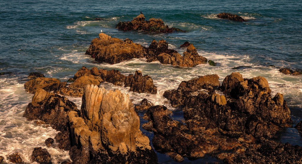
Once we entered the drive, we just drove slowly, enjoying both the view of the homes, golf courses, and resorts on one side and the magnificent coastline on the other. I took two photos on this part of the drive. One was of the ocean, just to contrast its activity with the much calmer bayside (1/640sec f/9 ISO 100).
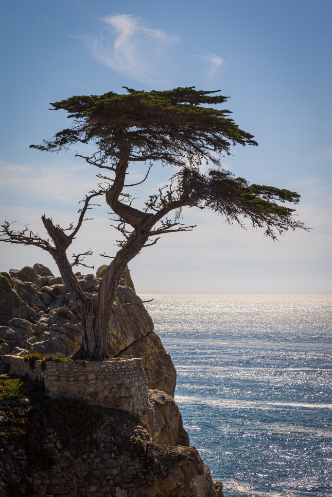
The other image and the one I was after, was — what is probably the most photographed tree in the world – the Lone Cypress. First of all, they didn’t make it easy to shoot. There were fences and other trees that are in the way while, on the other hand, they have provided a viewing platform. Unfortunately, that platform does not provide a broad variety of angled view points to the tree (translation: I couldn’t get at the view point I wanted).
But more importantly, the Pebble Beach Company long ago adopted the tree as its symbol and then in 1990, registered the Lone Cypress as a trademark for various services. Moreover, all their actions and pronouncements since then have implied that they have exclusive rights to the tree, itself. For example, a sign near the tree reads, “Photographs or art renderings of the Lone Cypress for commercial or promotional purposes cannot be taken or rendered without written permission from Pebble Beach Company. Photographs and art renderings for personal use only are welcomed.”
This is very controversial and possibly legally unsound. But in any case, it does create a kind of ‘chilling effect’ on anyone (at least it does on me). That company has way more money than I do; even if I was in the right, they could easily outlast me in court. So, in an abundance of caution, this is one image that has not been uploaded to my photography website (where it is possible to buy any image) but is presented here, where nothing is ever for sale, but is for the reader to view.
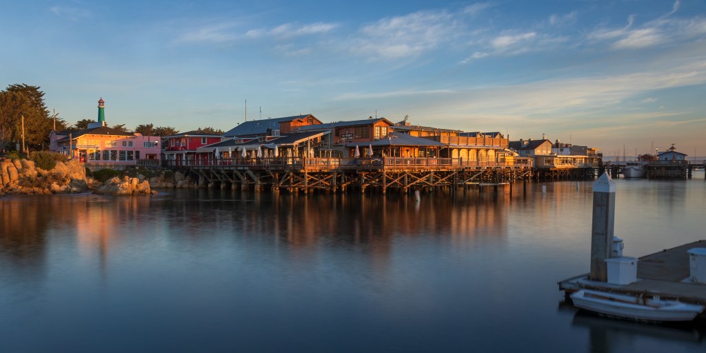
Before we left Monterey, I did get up earlier one morning, grabbed my gear and headed over to Old Fisherman’s Wharf to see what I might get in that nice, warm, early morning light. And, I did get two images I particularly liked.
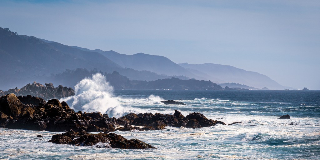
We also made a brief trip over to town of Carmel-By-The-Sea, and took a site-seeing drive down CA 1, south of Monterey to a bit past the Bixby Creek Bridge. And then we got ready to move on to Las Vegas.
Las Vegas area
The drive from Monterey to Las Vegas is fairly long — eight hours or more. Since our road trips are for pleasure, we try to keep the drive times to no longer than around four hours. Bakersfield was a place for us to stop and eat dinner, sleep, eat breakfast, and then continue on to our next destination. LV is also a destination that Lew & Louise enjoy a lot. For my wife and I, it is a place to use as a base to see other things nearby (but otherwise a great place to have some wonderful dinners and or to see a terrific live show).
The last time we were there (several years ago), we visited Red Rock National Conservation Area to the west of the city. This time I had researched Valley of Fire State Park — about an hour northwest of LV. After taking a day to just rest and take it easy (and review some of the photos I’d captured so far), I took a large chunk of a day to drive out to the park and start exploring. Below is a map of the park which I pulled from their website.
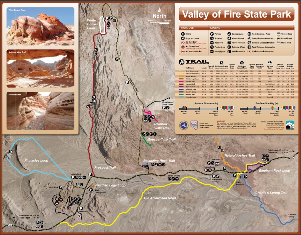
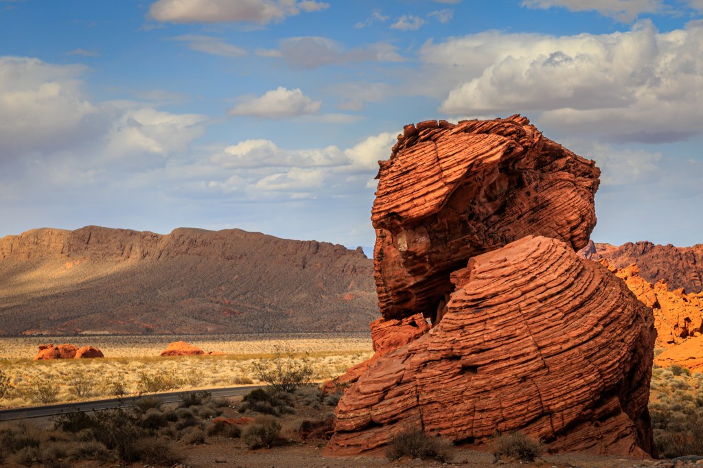
The park was much larger than I’d realized so I was only able to spend time sampling a few places along the western area of the park. In most places, I could get a reasonable photo by taking a short walk (too short to call it a hike) as I stopped along the way. The first five images in the slideshow below are of some of those short-walk stops; the first is close to the park entrance and the next four were taken along the very long northerly-oriented White Domes Road.
But I was also beginning to get nervous about getting back to LV on time for our scheduled dinner. On the other hand, I knew I wouldn’t be back to this park — at least not any time soon — and I wanted to check out (at least part of) an actual hike. From the park map, I had already decided to take on a section of the White Domes Loop trail (at the very top of the White Domes Road). What I didn’t realize was the changes in elevation on the hike (not the actual altitude but the changes that requiring climbing up and down) until I was at the site and committed.
Beehives rock formations – so named for hopefully obvious reasons (1/80sec f/16 ISO100) 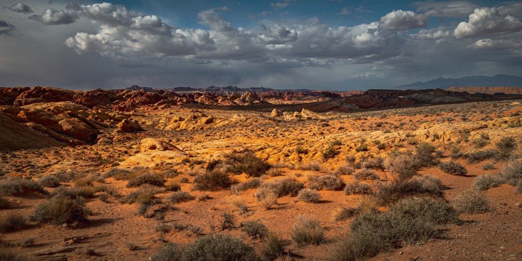
You can see a car on the White domes Road – this image provides some idea of the size of the park (1/160sec f/16 ISO 100) 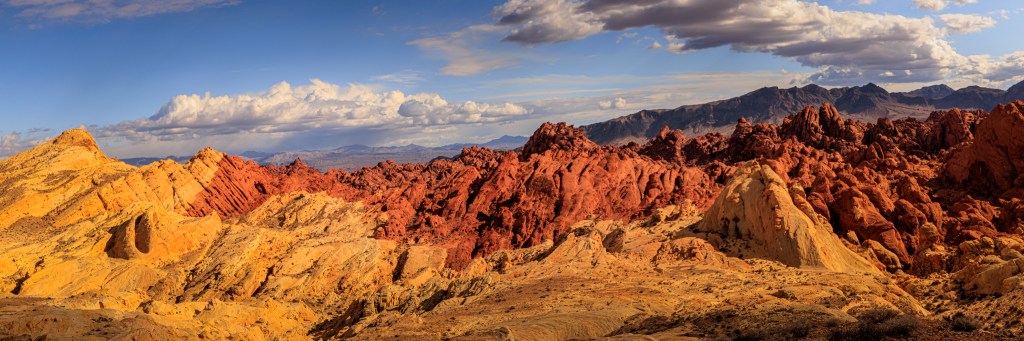
Fire Canyon / Silica Dome area – the sudden changes in rock colors is the result of geological shifting over long periods of time (1/200 sec f/16 ISO 100 multi-image panorama). 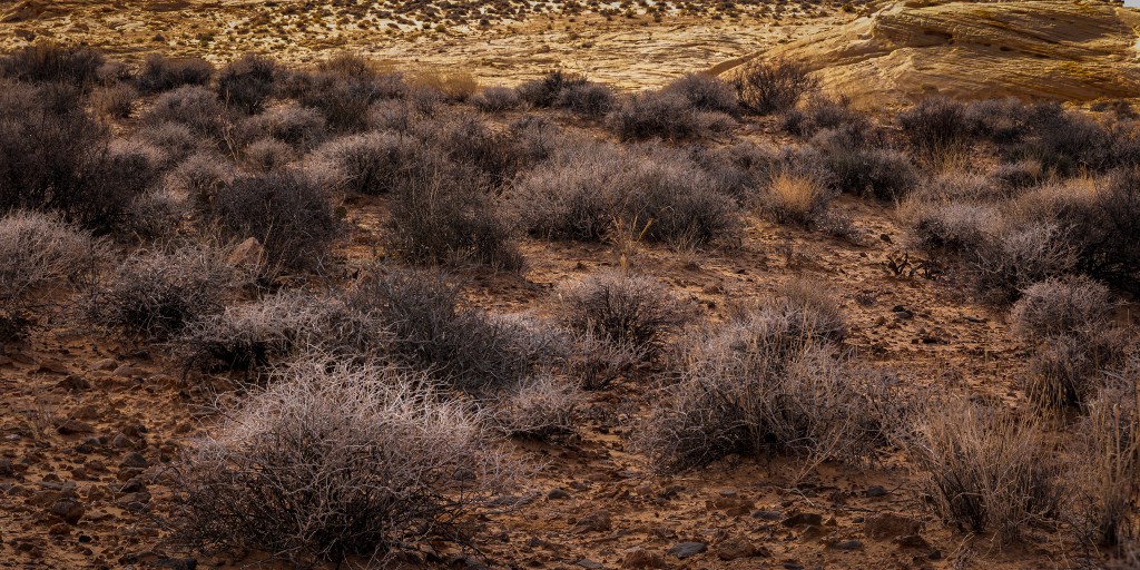
Field of sage brush near Fire Canyon – covered at that moment by a sun-blocking cloud (1/50 sec f/16 ISO 100 multi-image focus-stacked). 
One of the many small canyons formed by geological shifting over time – near Silica Dome (1/80 f/16 ISO 100) 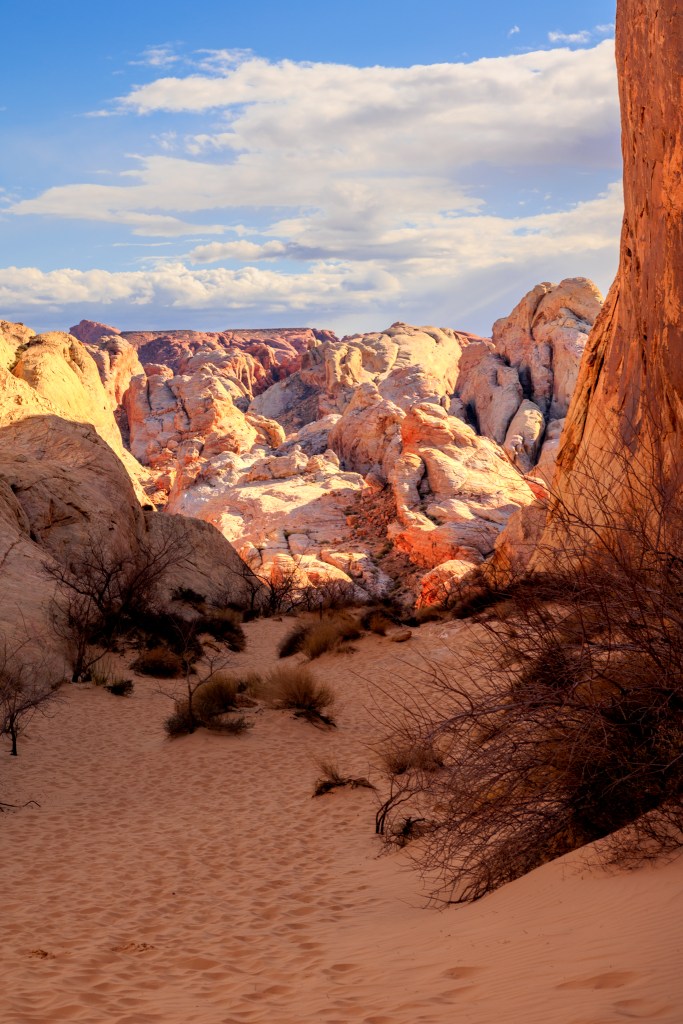
Top of White Domes Loop trail (1/80 sec f/16 ISO 100)- goes against one of my hiking guidelines, “Never start a hike at the top of anything – return is always uphill.” 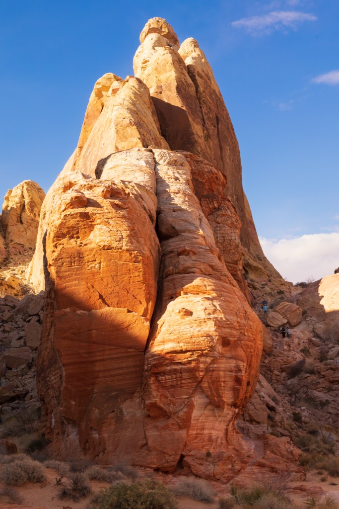
I violated my hiking guideline – part way down the White Domes Loop trail; people on the trail near the big boulders, midway (1/60 sec f/11 ISO 100) 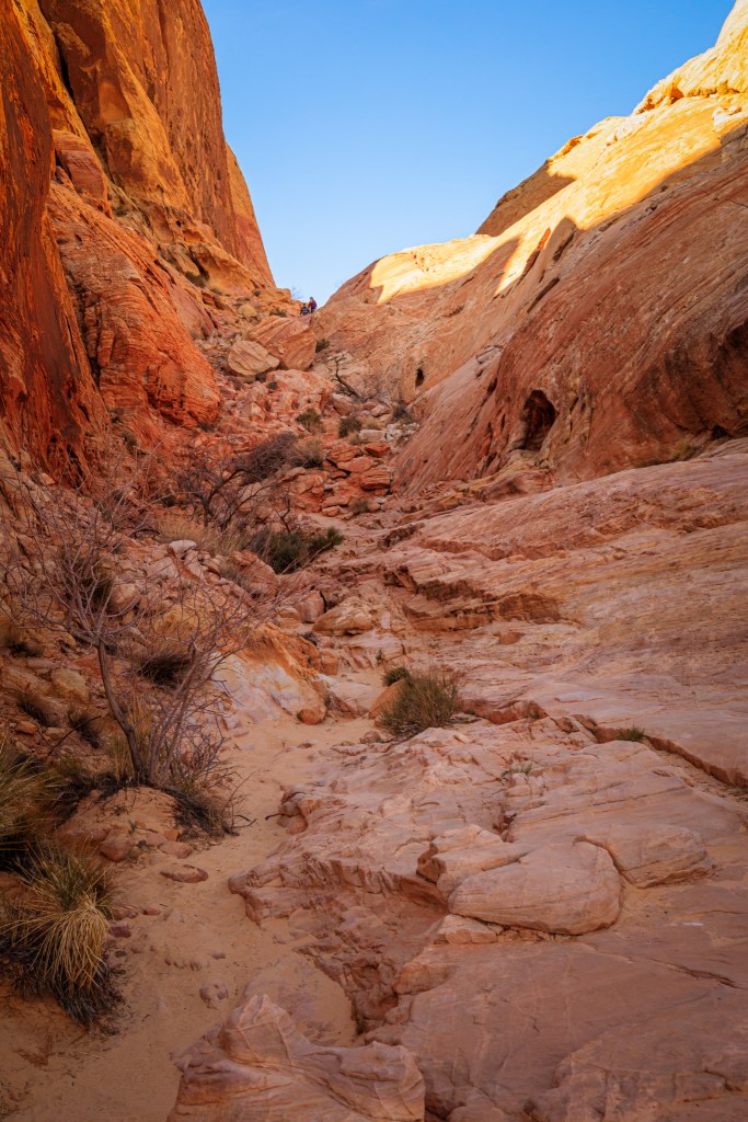
Another view of White Domes Loop trail from near the bottom – you can just see two people near the top of the trail (1/125 f/11 ISO 400).
Some of that hike was very challenging, especially because I began to rush to reach my car so I could begin the (minimum time) hour-long drive back to our hotel, probably in commuter traffic. The last two images in the above slideshow give some idea of the moderate difficulty caused by the steepness and ruggedness of the trail I had chosen. In both those photos you can just make out that there are people on the trail (which gives some sense of scale). After we were home, I measured the distance; one way of the section I traversed was only about 1/3 of a mile. Not too much distance but a bit dangerous to take it too fast. I’ve no idea of the actual elevation change but I estimate it was at least 250 feet. BTW, I’m here to write this post so I did manage to survive my rushing around. Also, I did make it back in time for dinner — barely.
One other thing about that hike, when I reached the bottom of the White Domes Loop trail segment, I came across the following remains of a wall (1/125 sec f/11 ISO 400). I thought, “Holy cow, someone actually built some sort of structure down here in this fairly inaccessible space?”
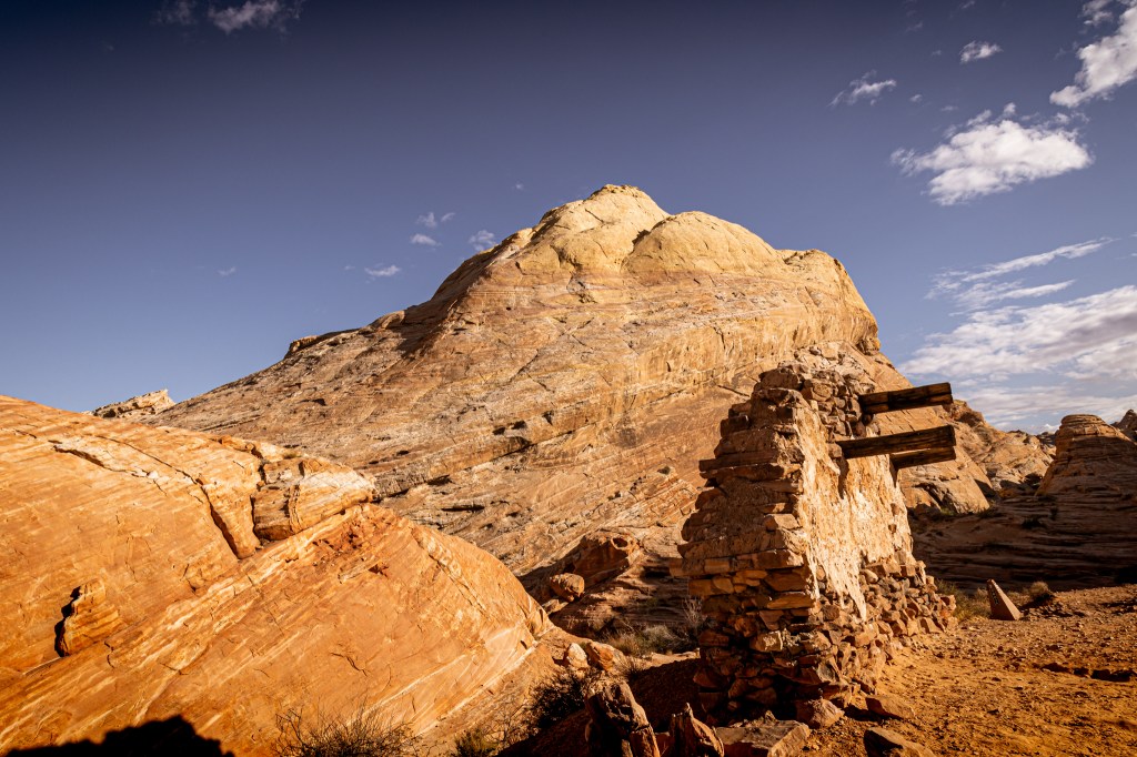
Then I turned around and saw a sign that explained everything about the wall fragment. It was actually the remains of a movie set from the western action film, “The Professionals” released in 1966. It included Burt Lancaster, Lee Marvin, Robert Ryan, Woody Strode, Jack Palance, Claudia Cardinale, and Ralph Bellamy.
Apparently, the park has been used commercially as a film site over 45 times a year but these days the projects are overseen by park rangers so that the only things that film companies can leave behind are footprints.
Las Vegas was where our friends and we ended our ‘together’ part of the road trip but we’re already talking about when and where we’d be getting together again. Their plans had them staying in LV for another couple of days and then flying home to Florida from there while my wife and I were facing at least a two day drive home.
Heading Home
In fact, as you might have guessed from the road trip map at the top of this post, we were not planning to go directly home. We had also planned a brief stay in Los Angeles to visit our eldest son and his family. So, our first day drive took us to see them in their new home. Sadly, there was a bit of sickness (nothing serious) going around the family so (being very cautious, senior citizens) we cut our visit short to just a couple of hours and the next day drove back home to the Bay Area.
If you’ve read this far, thank you. I hope you enjoyed it. Please, don’t forget that many (not all) of the photos in this post can be found on my photography website – the easiest way to see just the new ones is to choose the menu item, What’s New, so you don’t have to search around for them by location or category (the newest images are always at the top of the pile). The main reason to view photos on that site is that every image can be viewed larger and, therefore, in more visible detail.
Another way to view the images larger is to go to my Flickr site, (albums there are organized by year) where I also include all the images included in the blog post (and once I get my version of Adobe’s Lightroom Classic fixed, I’ll complete doing that for the blog [only] images N.B. LR repaired and blog images uploaded 4/21/22).
You may have noticed that I included a small bit of technical photo-exposure metadata information (throughout this post). I know that for most of my readers, it is unnecessary and possibly even distracting information. I included it because some readers are interested in photography and understanding a bit about the choices I make might be helpful to them. For them, in particular, I’ve written an additional post — a kind of sub-post to this one — a tutorial on photographic image exposure which provides information on the basics of exposure and then goes on to use a few images from this post to explain a bit more about my choices (meaning, why I chose what I chose).

3 Comments