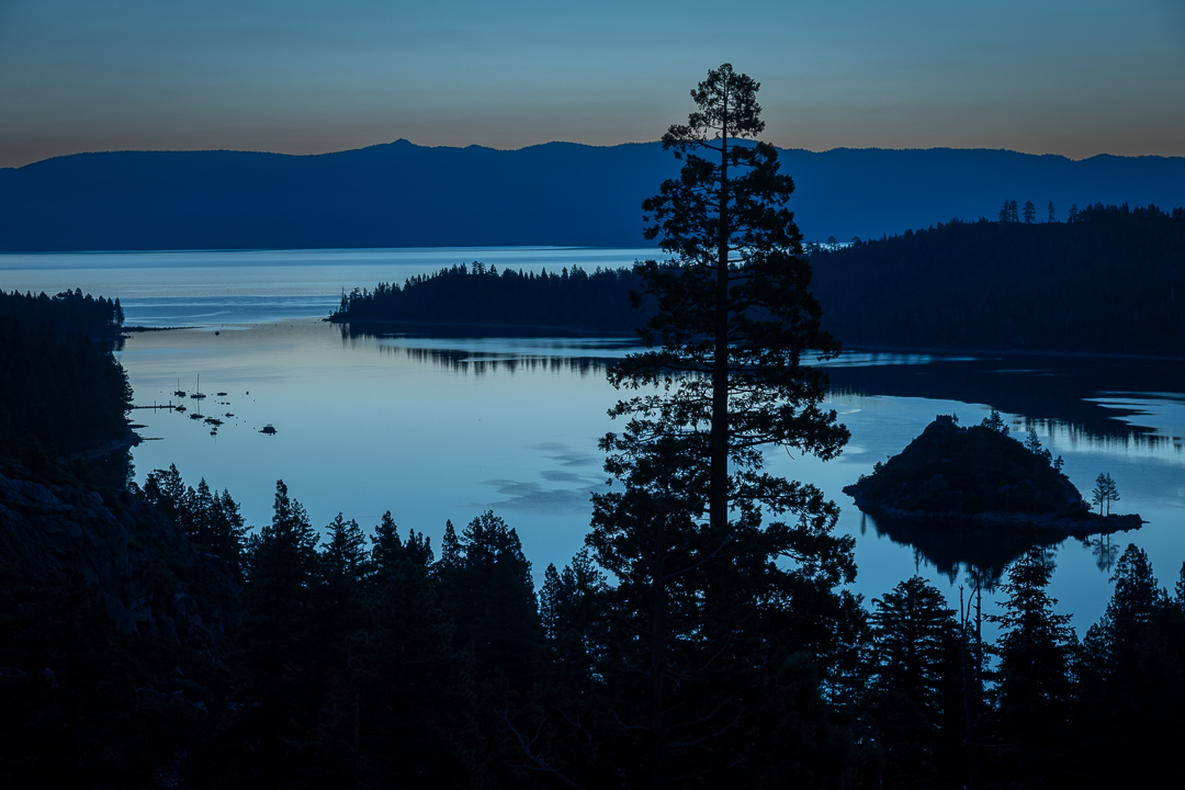
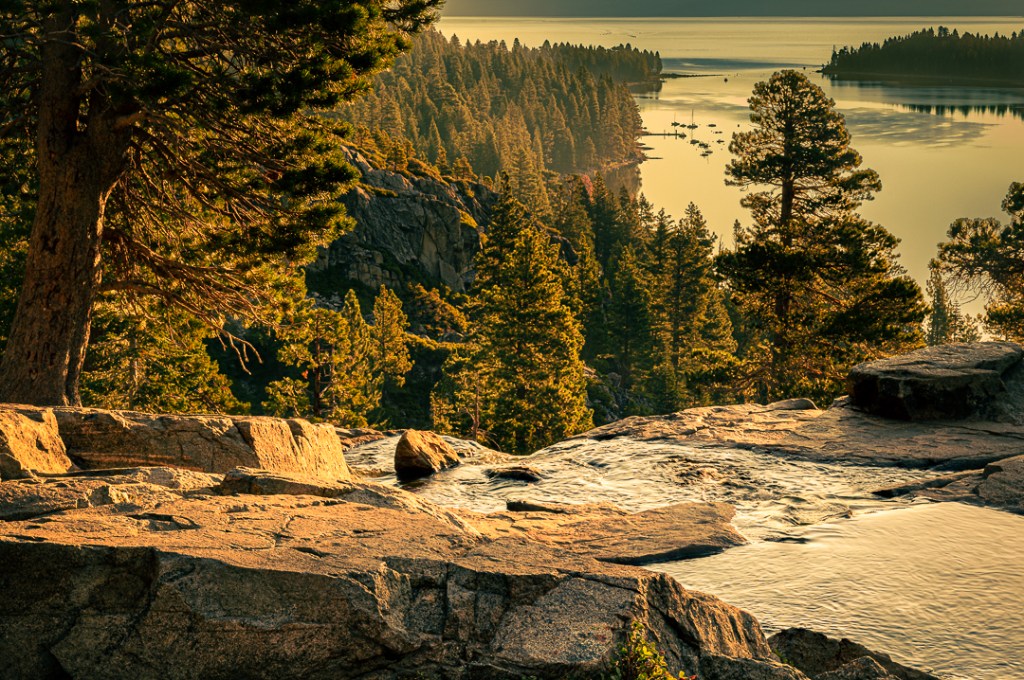
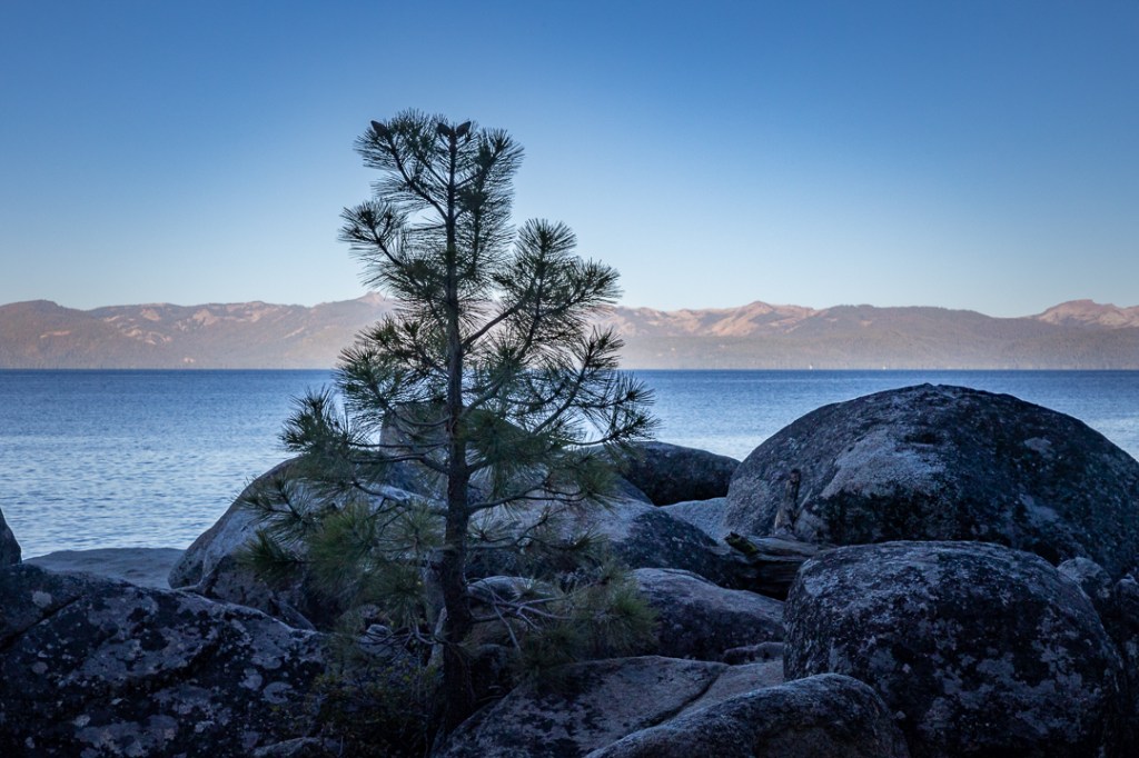
This image(1/25 sec, f/7.1, ISO 200, 75 mm) of the south end of Lake Tahoe from above Emerald Bay, was captured while on this trip at around 6 AM at the end of what is called the ‘blue hour’1 that occurs early in the morning (it also occurs in the evening).
I took that shot even though the sky was not very interesting (it would have been better if there were at least a few clouds above the mountains). But because the rest of the scene was just so blue, calm, and (to me) kind of restful, I set up and happily took it. I was very aware that I’d taken other early morning images of this scene over the years; I was also fairly certain that I’d not captured anything that was so definitely deep in the ‘blue hour.’
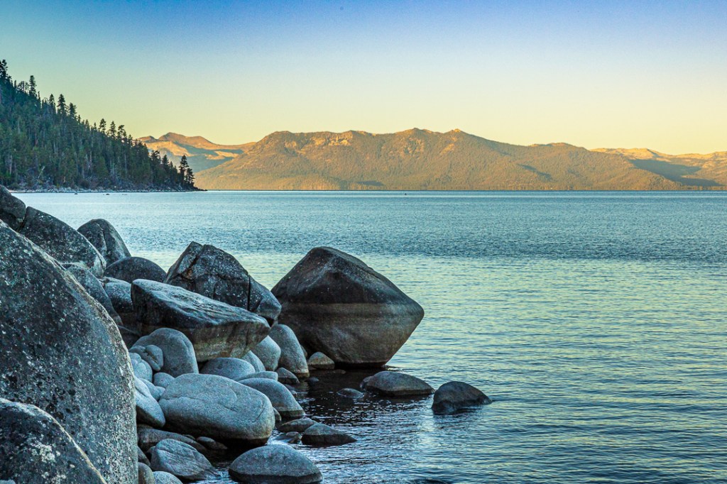
Regular viewers of my photography website have likely seen those earlier images before but my blog posts were much less frequent and less complete in 2016/17 when these other photos were taken. So, I put together this quick slide-show of several images taken from the same general location and at about the same time.

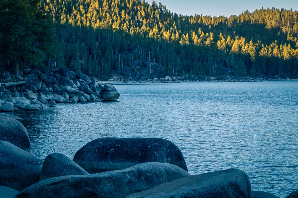
Emerald Bay during “golden hour” (1/80 sec, f/18, ISO 100, 32 mm) – 9/6/2017 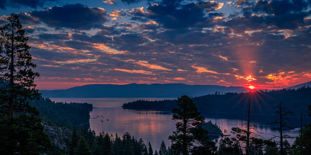
Sunrise breaking through over Emerald Bay (1/6 sec, f/16, ISO 100, 25 mm) – 9/3/2017 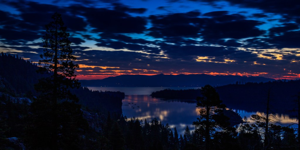
Emerald Bay as “blue hour” gives way to sunrise (30 sec, f/9.0, ISO 100, 24 mm) – 9/3/2017 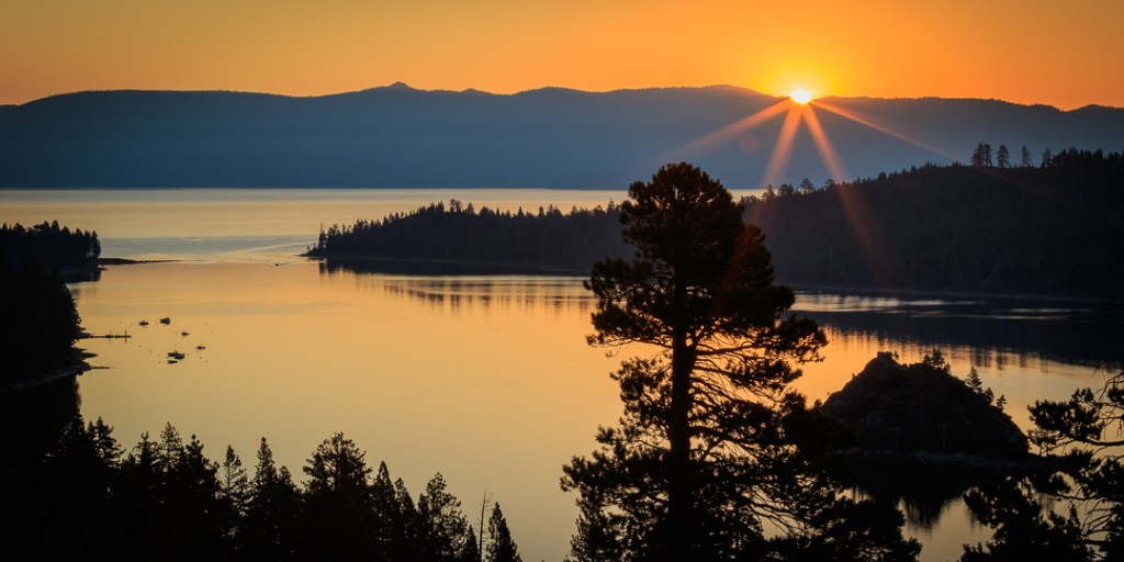
Sunrise beginning to light Emerald Bay (1/60 sec, f/18, ISO 100, 50 MM) – 8/12/2016
This was our first trip back to the Lake Tahoe region in several years. We did have a trip scheduled and booked for 2020 but you can easily guess what happened to that idea. So, it was with some degree of excitement that we drove up to the mountains looking forward to a week up there. We also invited our sister-in-law, Leslie, to join us — which she did and seemed to enjoy it very much. We definitely enjoyed her company there.
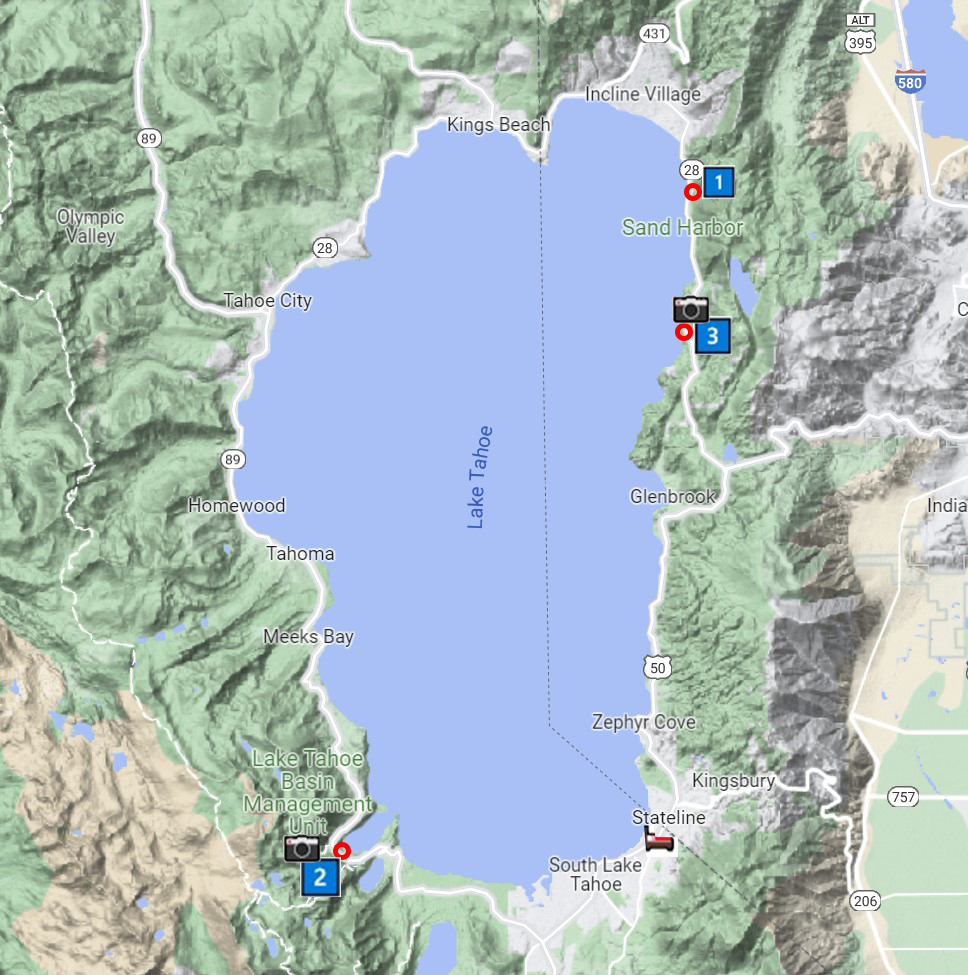
Partly because the change from sea-level to over 6,200 feet elevation takes at least a few days for our bodies to adjust, our initial plan was to just take it easy and enjoy the gorgeous scenery and some wonderful meals at our favorite local restaurants. Of course, I also planned to eventually spend a couple of mornings out with my camera gear and see what kinds of images I might be able to capture. I’ve put together a map (thank you, Google, for the map) and annotated it a bit to show where things occurred.
My First Photography Morning – Sunday
We were staying in South Lake Tahoe, very near the state line between California and Nevada on the California side (marked on the map by the little bed icon). I had a specific location in mind for shooting that morning on the Nevada side of the lake, called Memorial Point (marked with a ⭕ and 1️⃣). I’ve tried shooting up there in the past and, among other issues, I had always underestimated the time it took to drive there (so this time I left at about 4:15 AM, determined to get there well before sunrise). My intention was to use the Point as a base, and to hike both north and south along the shoreline trails looking for a spot to shoot some of the many granite boulders that seem to just naturally line the shore.
I arrived at around 5 AM (really, too early to begin shooting) and parked in one of the 20-minute parking spots (hoping that as long as I was nearby and it was earlier than about 7:30 AM, no one would complain or ticket me for parking more than 20 minutes). When I arrived, as you might guess, my car was the only one there. It was still dark, so I started to just scout the area, looking for a likely spot to setup. While I was looking around, I found that both trails had paper signs posted indicating that on that specific day (August 21), starting at 6 AM until around 9 AM, the trails were closed (without any explanation why or what would be going on).
Since the trails were declared closed at just the time when I was hoping to use them, I spent a few minutes thinking about an alternative location and, since it was still quite early, decided to drive around through the south end of the lake, past where we were staying, to the area in California above Emerald Bay (marked on the map with a ⭕, 2️⃣, and 📷 — the camera to indicate that I actually took photos there). I arrived there a bit before 6 AM, parked near the trailhead for Eagle Lake, crossed the highway, and setup for the shot at the top of this post.
Because it was obvious the sky was going to continue to be cloudless, I primarily looked for compositions that either minimized any sky element or didn’t include any sky at all.
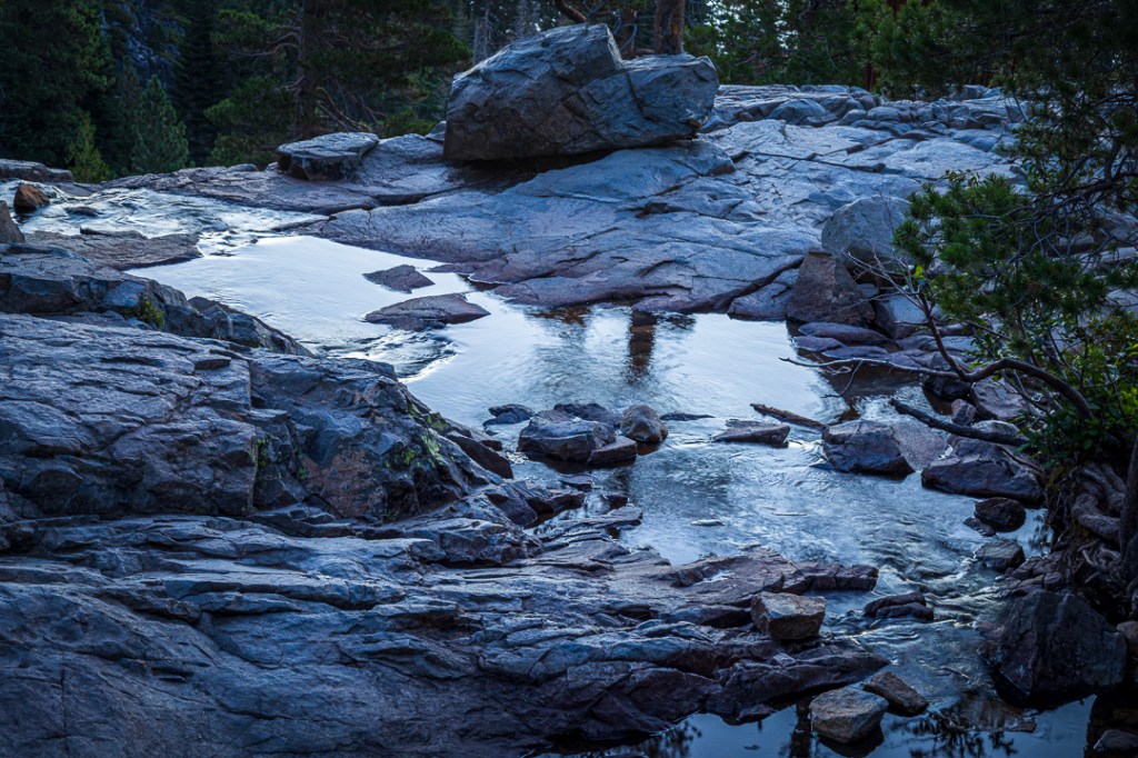
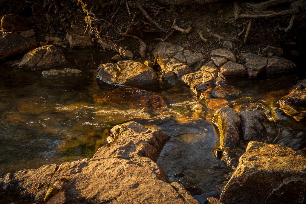
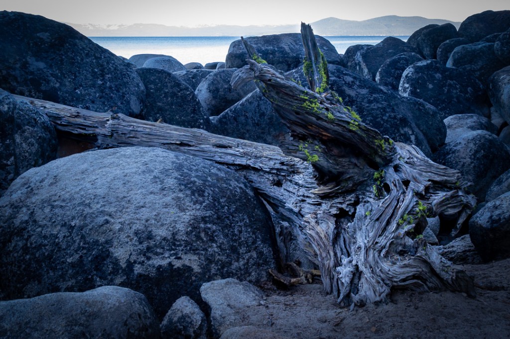
Though I was disappointed at not being able to follow my original plan of exploring some of the shoreline via Memorial Point, I thoroughly enjoyed re-working the area around [lower] Eagle Falls,2 trying to create satisfying compositions and particularly looking for images I’d not created on previous trips to the location.
One thing I found hard to not notice was the substantially reduced level of the water at the [lower] Eagle Falls2 site, almost certainly a result of our multi-year drought. Once again, I went back to photos I’d taken five years ago to find a comparison image. Although this picture is taken from a different perspective than the [lower] Eagle Falls2 pictures shown above, it is of the same scene and clearly shows a great deal more water and flow.

In addition to spending about an hour shooting in this area, I also ran across a young couple just enjoying the morning scenery and occasionally taking some pictures of their own, I did stop for a few minutes to talk with them (at their request I even took a portrait of them). I mentioned what had happened to my plans that morning and they told me about another spot on the Nevada side that I might want to explore called the Secret Cove. Once I got back to where we were staying, I looked it up on both Google Maps and a Topo map of the Lake Tahoe region — and decided to give it a try on my next outing. Then, after beginning to review the photos from that day, I decided that I’d earned a nap before heading out for dinner. 😴
My Second Photography Morning – Tuesday
As part of my preparation for going to a place for the first time (particularly since it might be somewhat dark when I got there) I bought a hiking trails app for my phone to help with location and navigation. Of course, I also re-charged camera batteries, replaced the batteries in my headlight, cleaned lenses, and decided to leave a little later than my first attempt (I didn’t need to reach the location in the dark as I had on Sunday).
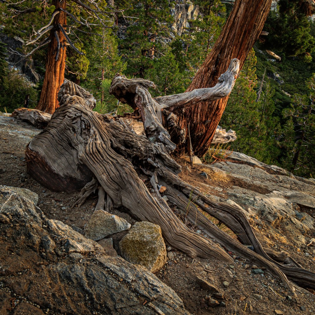
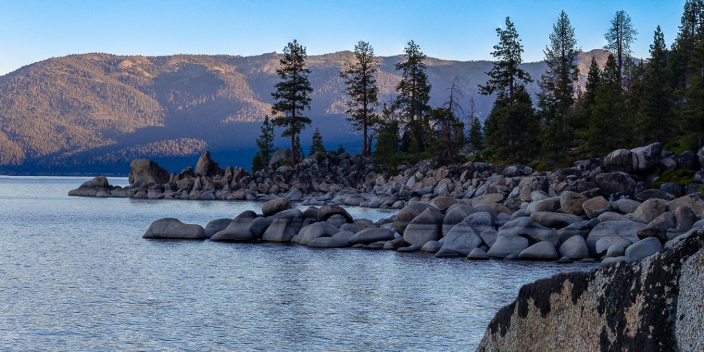
Leaving at 5:45 AM, I reached what I felt was a good parking spot on the lakeside shoulder of the highway (marked on the map by a ⭕, 3️⃣, and 📷) at about 6:10 AM, located a nearby trailhead, and (ignoring my normal rule to never start a hike with a downhill leg) started following a fairly steep trail according to the navigation information on my new app.
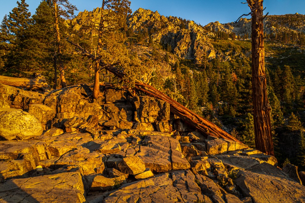
Although the area was still in shadow, it was obvious that the sunrise had already begun since the mountains across the lake were about halfway sunlit when I started down. It took me about 25 minutes to reach the shoreline and then I began to search for compositions and places to setup. I started shooting at around 6:45 AM. Here are several of the photos from that morning.
All in all, I spent about 45 minutes shooting that morning, and then packed up my gear and started hiking back out. Fortunately, the hiking app had kept track of my wandering and made it easy for me to orient myself toward my parked car. Unfortunately, it did not make the hike (climb) back up the steep slope easy at all. For me it was climb until my breathing became too difficult, stop, and recover, repeat — until I finally reached the road. I never checked the time when I finally reached my car – I was just relieved to be sitting down and heading back to South Lake Tahoe.
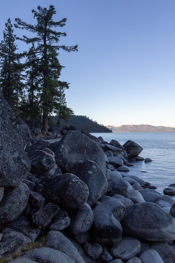
Much later, when I was reviewing the images on my computer, I noticed something that had not really registered with me while I was out shooting. And that was that the stains on many of the boulders indicated that the level of the water in the lake had dropped considerably — by at least a foot or so. This is another indication of the effect the drought is having even in the mountains. It is most noticeable in both the first and last photos in the series above.
We spent a couple of more days just enjoying our time at the Lake before turning our car west and heading home.
I hope you enjoyed this post, primarily of my adventures taking photos at Lake Tahoe. We are planning on another stay there soon, so hopefully I will find some other images to share.
I am, unfortunately, having some computer issues with the software I normally use to load images from my system to the site that hosts my photography website (so none of the photos in this blog have been loaded to that site — yet). Meanwhile, if you would like to view any of these photos in a larger format, to see more detail and probably somewhat more robust color, I have loaded them into my Flickr site. Until I add other photos there, these dozen photos will be visible in the Album named 2022 as the most recent addition — the most recent image shown at the top of the stream). You can link to my Flickr site here. Then select Albums from the menu and click on 2022.
Footnotes:
1 The phrases ‘blue hour’ and ‘golden hour’ are photography terms used to describe the changes in the color of light that occur at sunrise and sunset. First of all, the word ‘hour’ is used merely to designate that the terms are about a time period; they are rarely an hour long. And those times change based upon the date, elevation above sea level, location, and where the local horizon is. They are defined precisely: (a) blue hour is when the sun is between -4 and -6 degrees below the horizon and (b) golden hour is when the sun is between -4 degrees below the horizon and +6 above the horizon. For example, on Sunday, August 21, 2022 at Lake Tahoe above Emerald Bay, morning blue hour only lasted ten minutes while golden hour lasted 54 minutes.
2 You probably won’t find the term “[lower] Eagle Falls” on maps (at least, none that I’ve seen). I invented it because if you check a map yourself, you will likely find a designation for Eagle Falls to the west of highway 89 above Emerald Bay, and you may find another designation for Eagle Falls to the east of the highway also above Emerald Bay. They are both in the same creek fairly widely separated from each other but still in the same water channel. I use the term, [lower] Eagle Falls to refer to the waterfall that is east of the highway, to avoid any confusion for folks who might spend time sightseeing or hiking in the area.
Finally, just FYI, Eagle Creek is fed from Eagle Lake which is a mile or so west of the highway, higher up in the mountains. I have hiked to that lake in the past, several different times along with various family members, (when I was younger and more adapted to the elevation). In addition, that trek follows my basic hiking rule of starting out being uphill, and therefore downhill on the return). 😁

2 Comments